Geography
The Indian subcontinent is a peninsula that extends southward from the rest of Asia, resembling that of an enormous arrowhead. The subcontinent is a self-contained landmass because it is separated from the rest of Asia by the prodigious Himalayan Mountains. While this country has a distinct landmass, the Indian subcontinent is not large enough to be considered a continent.
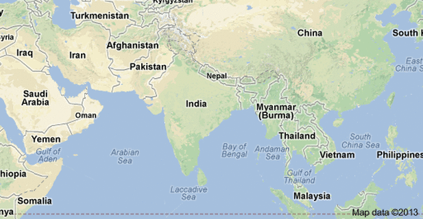
Any country that is surrounded by water on three sides and landlocked on the fourth is called peninsular. India is bounded by the Indian Ocean on the south, the Arabian Sea on the south-west, and the Bay of Bengal on the south-east while the fourth side of its subcontinent is landlocked with Himalayan Mountains. This is why India is considered a peninsular country.
India shares land borders with Pakistan to the west; China, Nepal and Bhutan to the north-east; and Burma and Bangladesh to the east. In the Indian Ocean, India is the vicinity of Sri Lanka and the Maldives; in addition, India’s Andaman and Nicobar Islands share a maritime border with Thailand and Indonesia.
Link(s):
http://www.mrdowling.com/612india.html
http://www.blurtit.com/q6027024.html
